Clear Sky Science · en
Ecological risk and source apportionment of heavy metals in riparian soil and sediment of an urban river in a developing country
Why this urban river matters to everyday life
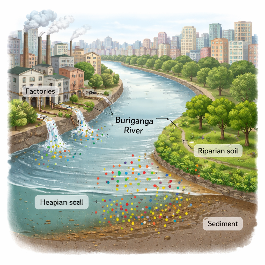
The Buriganga River flows through the heart of Dhaka, a megacity where millions of people live, work, and rely on the waterway for food, transport, and recreation. This study examines how invisible but dangerous heavy metals are building up in the river’s muddy bottom and along its narrow green banks, known as the riparian zone. Because these contaminated soils and sediments can pass pollutants into fish, crops, and groundwater, the findings speak directly to public health, urban planning, and the future livability of one of the world’s most crowded cities.
A closer look at a crowded, stressed river
The Buriganga has long been recognized as one of Bangladesh’s most polluted rivers, squeezed by rapid industrial growth, dense housing, and weak waste management. Its riparian zone acts as a thin buffer between land and water, filtering nutrients, slowing floods, and stabilizing banks. Yet this same strip of soil is where pollutants first arrive when factories discharge untreated wastewater, when rain washes road dust and solid waste into drains, or when farms apply metal-rich fertilizers and pesticides. The authors set out to measure how much heavy metal has accumulated in both the riparian soil and the riverbed sediment, and to judge what that means for the river’s ecological health.
How the scientists measured hidden contaminants
Researchers collected 45 riparian soil samples and 45 surface sediment samples from 15 locations along the river during the dry season of 2022. They focused on nine heavy metals of concern: chromium (Cr), nickel (Ni), copper (Cu), arsenic (As), cadmium (Cd), lead (Pb), iron (Fe), manganese (Mn), and zinc (Zn). In the laboratory, samples were carefully cleaned, ground, and digested with strong acids, then analyzed using an ultra‑sensitive instrument called an inductively coupled plasma mass spectrometer. To move beyond a simple “high or low” comparison, the team compared results to pre‑industrial background levels and to Dutch and Canadian soil quality guidelines, and applied a suite of standard indices that condense complex chemistry into simple risk scores.
What was found in the mud and along the banks
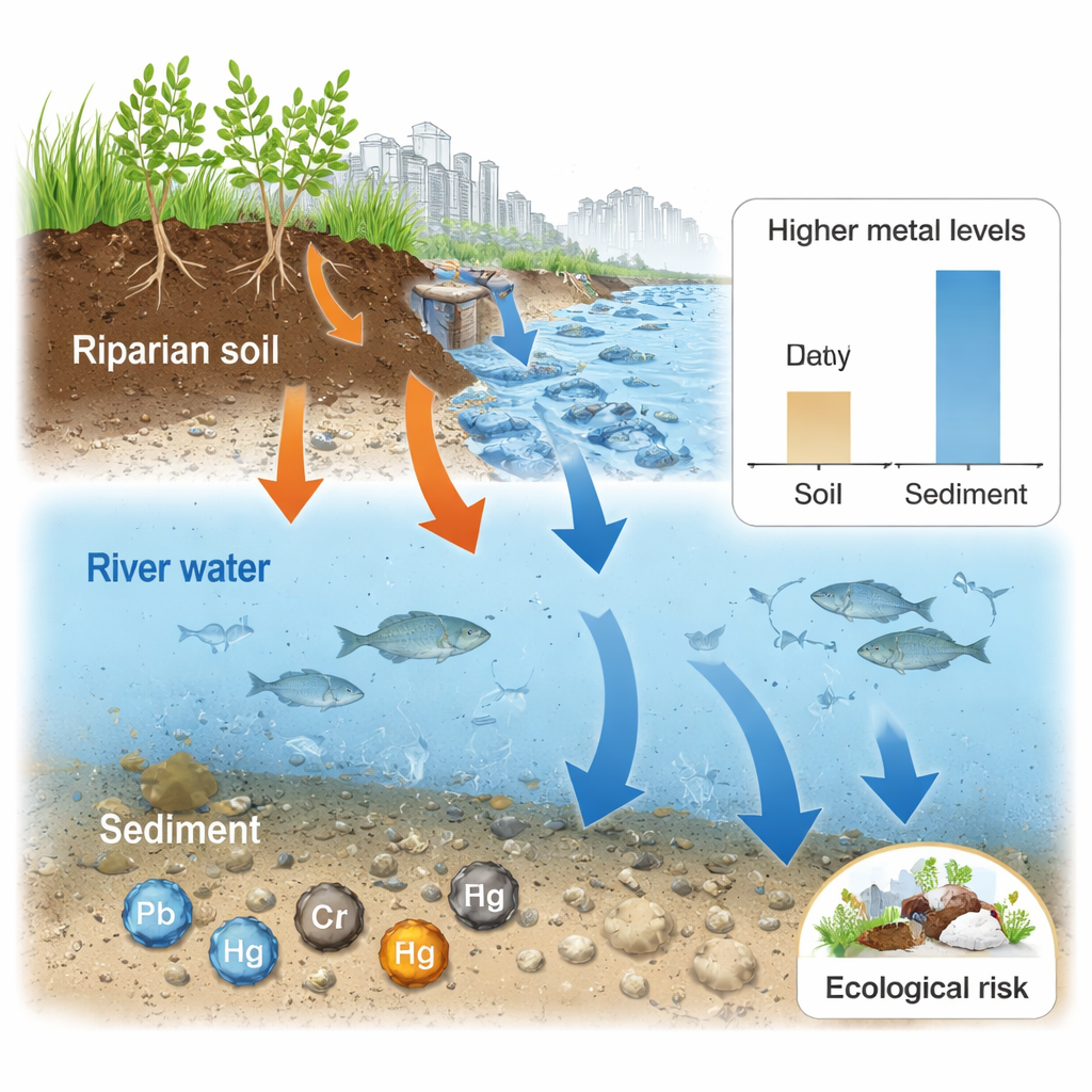
In almost all cases, metal levels were higher in the riverbed sediment than in the riparian soils, showing that the river acts as a long‑term sink for contamination. Average chromium, nickel and copper concentrations in sediment were roughly two to three times higher than international guideline values, while arsenic, cadmium and lead also frequently exceeded recommended limits in both soil and sediment. Downstream sites near shipbuilding, tanneries, and busy river ports were the most polluted, with especially high copper, arsenic, cadmium and lead. By statistically grouping metals that tend to rise and fall together, the authors traced most of the contamination to human sources: industrial discharges, waste burning, traffic and metal workshops, as well as intensive fertilizer and pesticide use in riverside fields. Natural weathering of rocks plays a role, but a smaller one.
Turning measurements into ecological risk
To translate concentrations into ecological meaning, the team used multiple contamination and risk indices. These indices consistently pointed to low to moderate pollution in most riparian soils and sediments, with more serious conditions at several downstream sites. Copper stood out as a major concern in soils, while cadmium, arsenic and iron strongly influenced the overall risk scores in both soils and sediments. An index that estimates the likelihood of harmful effects on bottom‑dwelling organisms suggested roughly one‑fifth of riparian soils and about half of sediments pose toxicity risks. Overall, the potential ecological risk index classified most sites as low risk, but flagged three locations as facing moderate risk, reinforcing the idea of pollution “hot spots” rather than uniform contamination.
What this means for people and the river’s future
For a non‑specialist, the takeaway is stark but still hopeful: the Buriganga’s banks and bottom are already contaminated with heavy metals at levels that can damage aquatic life and, through fish and crops, threaten human health—yet the problem is still in a range where strong action can make a real difference. The riparian zone is doing some filtering, but it is being overloaded by untreated sewage, factory effluent, and poorly controlled farming practices. The authors argue that authorities must urgently identify and control point sources of metal pollution, enforce existing rules on industrial discharges, and plan restoration of riparian buffers. With better monitoring and management, this vital urban river can be steered away from long‑term ecological harm and toward a safer role in Dhaka’s future.
Citation: Islam, M.S., Al-Bakky, A., Islam, A.R.M.T. et al. Ecological risk and source apportionment of heavy metals in riparian soil and sediment of an urban river in a developing country. Sci Rep 16, 4856 (2026). https://doi.org/10.1038/s41598-026-35479-5
Keywords: heavy metal pollution, urban river, riparian soil, sediment contamination, Bangladesh environment