Clear Sky Science · en
Comparative analysis and verification on broken rock zone of model test based on multiple testing methods
Why Cracked Rock Matters Underground
Deep underground tunnels and roadways, such as those in coal mines, are surrounded by rock that can crack and crumble as the ground shifts. This damaged ring of rock can threaten the stability of the tunnel and the safety of the people working there. The study summarized here asks a practical question: how can engineers actually see and measure this hidden “broken rock zone” in model experiments, so they can design safer support systems for real mines?
Peering into Rock with Multiple Senses
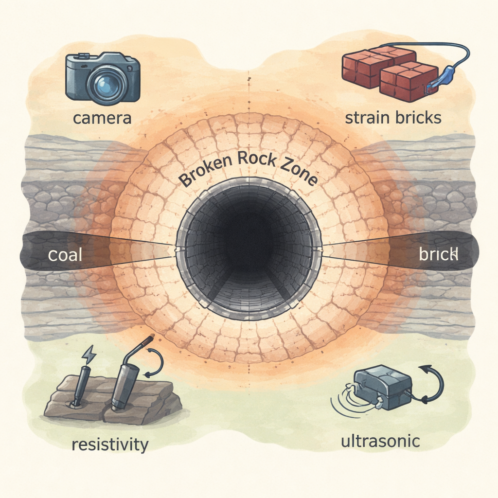
The researchers built large laboratory models based on a real roadway in China’s Chengjiao Coal Mine. In these models, they carved different tunnel shapes into blocks that mimic layered underground rock, then slowly applied stresses similar to those deep underground until the tunnels failed. To watch how the surrounding rock responded, they used four different monitoring approaches: tiny sensor blocks called strain bricks to track how rock stress changed with depth; high‑resolution digital photography to follow surface cracking and movement; electrical measurements to see how cracks affected the rock’s ability to conduct current; and ultrasonic waves to sense changes in rock quality. At the same time, they ran computer simulations that calculated how zones of deforming and broken rock should grow around the tunnels.
What Each Method Can and Cannot See
Each technique turned out to “see” a different slice of the problem. Strain bricks worked like buried feelers, revealing where the rock close to the tunnel lost its ability to carry load. When stress readings suddenly flattened near the opening, the team could infer that the rock there had broken, with deeper rocks still bending but not yet crushed. However, because only a few bricks can be installed, this method gives a coarse picture and can miss details of where and how far the broken zone spreads. Ultrasonic measurements, which track how fast sound pulses travel through the rock, were good at signaling that damage had begun, but they underestimated how thick the broken zone really was and struggled to capture its full development.
Pictures and Electricity Reveal the Hidden Ring
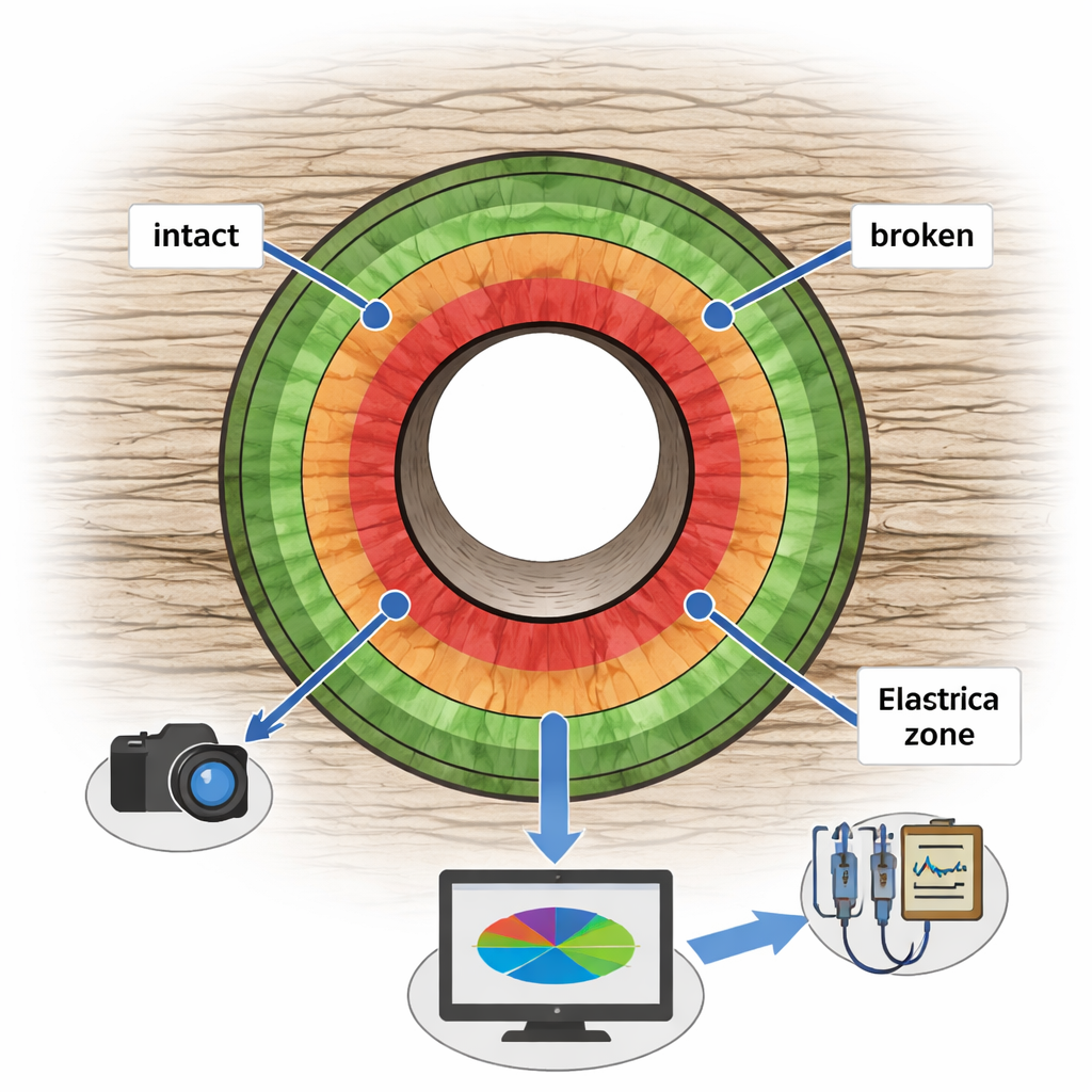
The most informative tools were the ones that could cover large areas at once. Using digital photography and a specialized image‑analysis system, the team converted time‑lapse photos of the model surface into colorful maps of how much different parts of the rock moved and stretched. Large displacements and clear crack paths lined up with the emerging broken rock zone, showing where roofs were sagging, walls were bulging, and floors were heaving. In parallel, an electrical method measured how the rock’s resistivity changed as cracks opened. Cracked and heavily damaged regions carried electrical current much less easily, forming high‑resistivity halos around the tunnel. From these resistivity maps, the researchers could trace the broken rock zone, the surrounding plastic (bending) zone, and the still‑intact rock farther out.
Checking the Lab with Computer Models
To be confident in what the instruments were telling them, the authors compared their measurements with detailed numerical simulations of the same tunnel layouts. The simulations showed how a “plastic zone,” where rock bends and yields, and an inner broken rock zone should expand as loading increases. By analyzing changes in the difference between the largest and smallest stresses in the model, they could mark off where rock would first start to deform and where it would ultimately fracture. These simulated plastic and broken zones matched closely with the displacement patterns seen in the photos and with the high‑resistivity shells from the electrical method, while highlighting where strain bricks and ultrasound were missing or underestimating damage.
What This Means for Safer Underground Spaces
For readers, the key takeaway is that no single sensor can fully capture how rock around a tunnel fails, but some tools are clearly more powerful. The study recommends combining digital photography with electrical measurements in model tests to map the size and shape of the broken rock zone much more reliably. These richer pictures of where rock truly breaks versus merely bends can feed back into better support designs for real tunnels and mines, helping engineers anticipate roof falls, wall collapses, and floor heave before they happen.
Citation: Liu, G., Liu, Z., Luan, Y. et al. Comparative analysis and verification on broken rock zone of model test based on multiple testing methods. Sci Rep 16, 5088 (2026). https://doi.org/10.1038/s41598-026-35290-2
Keywords: underground tunnel stability, broken rock zone, rock mass monitoring, coal mine roadway, numerical simulation