Clear Sky Science · en
Optimising resources and localising sustainability through hierarchical village clustering in Nagpur Metropolitan Region, India
Why village clusters matter for everyone
How can a country with hundreds of thousands of villages bring good roads, jobs, health care, and clean water to people without wasting scarce money and land? This study looks for an answer in the Nagpur Metropolitan Region of India by treating villages not as isolated dots on a map, but as connected clusters that can share services and build on each other’s strengths. By carefully grouping villages and studying their surroundings, the authors show how governments can plan smarter – stretching every rupee further while improving everyday life for rural communities.
From one-size-fits-all to place-based planning
Rural and urban areas face very different realities. Cities often focus on sturdy infrastructure and diverse jobs; villages depend more on farming, local resources, and tight-knit communities. National plans like the UN Sustainable Development Goals are ambitious, but they can feel distant from the everyday concerns of a drought-prone farming village or a forest-fringe tribal hamlet. This paper argues that “localising sustainability” means starting from what each village already has – its land, people, skills, and location – and then tailoring support to fit those assets instead of applying a uniform recipe everywhere.
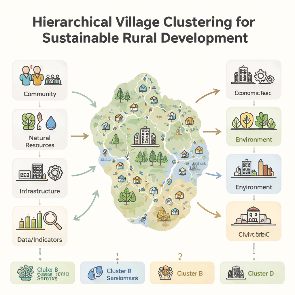
How the researchers grouped the villages
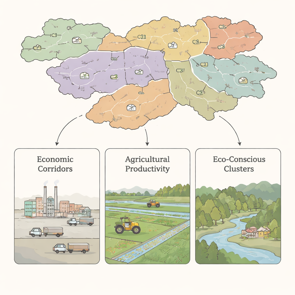
The authors examined 721 villages in the Nagpur Metropolitan Region, a mix of urban, peri-urban, and rural landscapes in central India. They assembled detailed information on each village: distance to highways, rail and metro lines, access to banks, schools and clinics, nearby industries, irrigation, forest cover, flood risk, and more. Using mapping software (GIS) and statistical tools, they converted these diverse facts into a common score scale, then applied a hierarchical clustering method that naturally groups villages with similar conditions without pre-deciding how many groups there should be. The result was seven spatially coherent clusters, each with its own profile of strengths and vulnerabilities.
What the clusters reveal on the ground
The seven clusters fall into a few clear types. Some, near highways and industrial zones, are “economic generation magnets” where jobs, logistics, and population are growing quickly. Others sit on fertile, well‑irrigated land with double cropping and strong farming traditions, forming “agricultural productivity” clusters that can anchor regional food security. A third type is rich in forests and natural resources, offering cleaner air and water but facing threats from deforestation, fragmented habitats, and limited livelihood options; these become “environmental sustainability” clusters. One mixed cluster combines several land uses and faces issues such as flood risk and land‑use conflicts as rural settlements feel the pressure of nearby urban expansion.
Turning clusters into smarter action
Seeing villages as clusters rather than stand-alone units changes how resources can be planned and shared. Instead of building separate facilities in every village, a centrally located health center, agro‑processing unit, or storage facility can serve several nearby settlements, cutting travel time and costs. Industrial clusters can tap corporate social responsibility funds for local schools, roads, and environmental safeguards. Farming clusters can prioritize better irrigation, storage, and modern techniques like precision irrigation to boost yields. Forest-edge clusters can focus on conservation, eco‑tourism, early warning systems for floods, and mobile health and education services. Across all types, clustering encourages knowledge sharing, joint investments, and stronger social ties, helping small villages act together at a scale that attracts meaningful support.
What this means for rural futures
For a lay reader, the key message is that where a village sits – in relation to roads, cities, farms, forests, and rivers – strongly shapes what kind of development will work best there. The study’s hierarchical village clustering framework offers a practical way for governments and communities to read this landscape and design interventions that fit it. By grouping similar, neighboring villages and planning for them together, authorities can reduce wasteful duplication, target real needs, and give villagers a stronger voice in shared projects. In short, smart clustering can turn scattered rural pockets into connected, resilient communities that move toward sustainability on their own terms.
Citation: Pathak, V., Deshkar, S. Optimising resources and localising sustainability through hierarchical village clustering in Nagpur Metropolitan Region, India. Sci Rep 16, 5749 (2026). https://doi.org/10.1038/s41598-026-35231-z
Keywords: rural sustainability, village clustering, spatial planning, resource optimisation, Nagpur Metropolitan Region