Clear Sky Science · en
A unified plant ecology database for Spain
Why this new map of Spanish plants matters
Spain is one of Europe’s richest natural treasures, with landscapes ranging from wet Atlantic forests to sun-baked Mediterranean hills and snowy alpine peaks. Yet information about where plants live, what environments they need, and how climate change may reshape their ranges has long been scattered across many different sources. This article introduces geoSABINA, a unified, freely available digital atlas that brings together all this knowledge for mainland Spain, giving scientists, land managers, and citizens a powerful tool to understand and protect the country’s plant life.
Bringing scattered plant data into one home
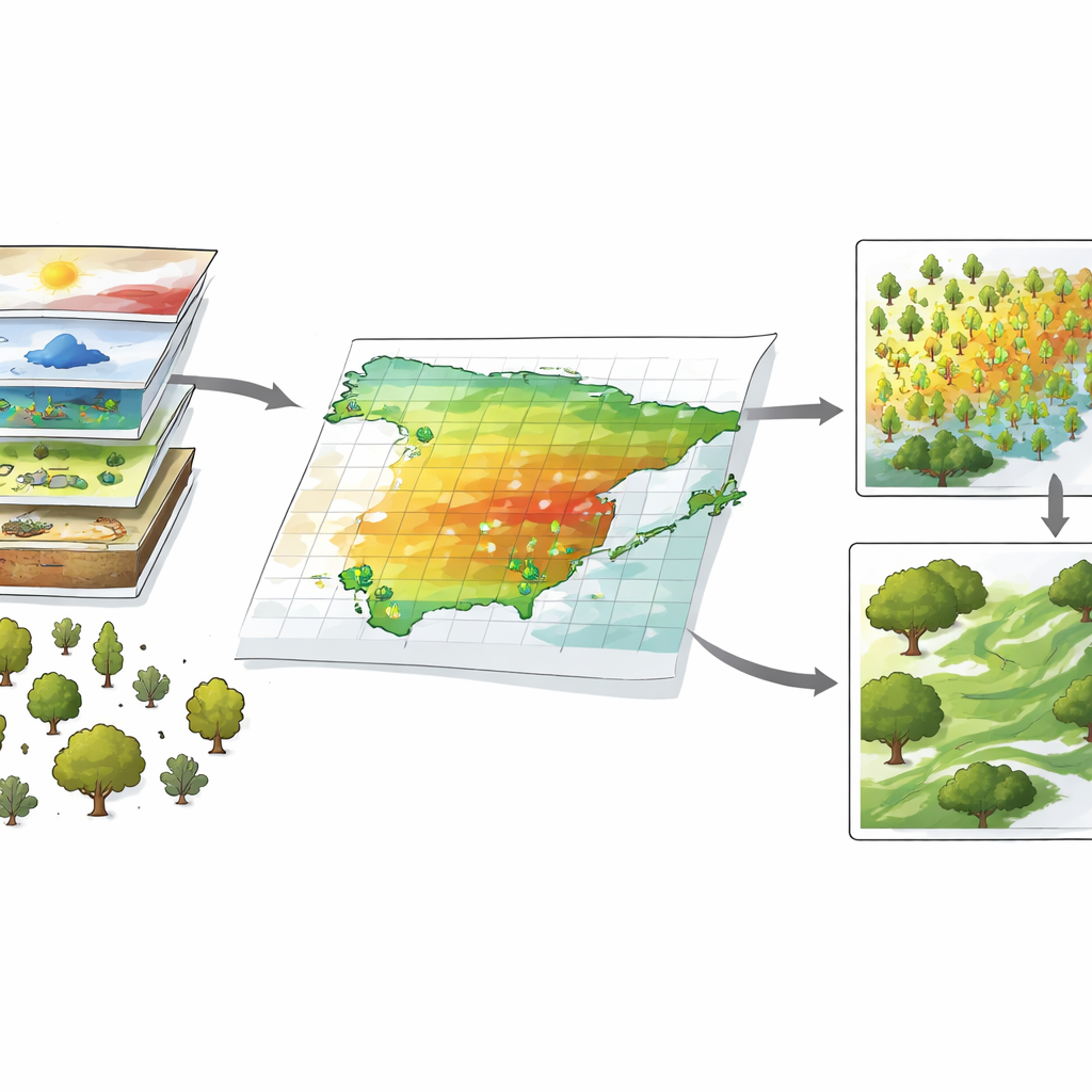
Until now, anyone trying to study Spanish plants at large scales had to track down many separate datasets, often in different formats and with uneven quality. GeoSABINA tackles this problem by assembling four main types of information in one coherent package. First, it gathers precise records of where plants have been found: detailed locations for 81 tree and 101 shrub species, plus national “atlas” maps for 6,456 vascular plant species and subspecies and 1,252 mosses and related plants. These records come from forest inventories, national maps, scientific collections and specialized studies, and have been carefully checked by experts to remove errors such as cultivated plants or doubtful identifications.
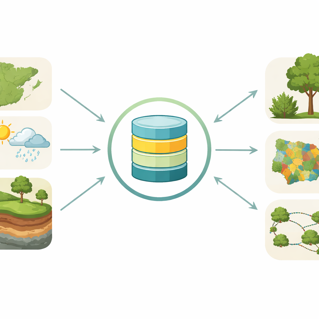
Linking plants to climate, water and soil
Knowing where species are found is only half the story; understanding why they occur there requires environmental context. GeoSABINA therefore includes high-resolution climate data (such as temperature and rainfall patterns), soil characteristics (like acidity, nutrients, and sand content), hydrology (distance to rivers, water flow, and wetness) and solar radiation for all of mainland Spain. These layers are provided not only for present-day conditions but also for four future climate scenarios covering the period 2071–2100, based on globally recognized climate models and greenhouse gas pathways. This consistency allows researchers to ask how today’s plant communities might respond if Spain becomes warmer, drier or more variable in the decades ahead.
From observations to smart maps of potential habitat
To turn raw observations and environmental layers into something more powerful, the team built computer models that estimate how suitable each part of Spain is for a given species. These “species distribution models” learn the environmental conditions associated with known plant occurrences and then project where similar conditions occur across the landscape. For trees, the authors used a two-level approach that combines Europe-wide climate limits with fine-scale Spanish data, reducing distortions that arise when only a small slice of a species’ range is considered. Shrub species were modelled with a simplified strategy suited to their more limited regional data. The team also created models for 174 legally protected plant species, but to safeguard these rare plants, only combined richness maps—not the precise model outputs—are made public.
Guiding conservation, restoration and connectivity
Building on these models, geoSABINA offers thematic maps tailored to conservation and land planning. One set of maps shows how many woody or protected plant species are likely to be present in each area, highlighting current and future hotspots of biodiversity. Another set describes the main types of vegetation—such as high-mountain communities, deciduous forests or drought-tolerant scrub—under both present and projected climates. A third group of maps focuses on “connectivity”: how forest patches and the corridors between them help animals and plants move across the landscape. By simulating movement over different distances and under several climate futures, the database pinpoints which patches and corridors are most crucial to keep ecosystems linked and resilient.
A shared foundation for future decisions
Behind the scenes, the authors invested heavily in harmonizing, validating and documenting the data so that everything lines up in space and time and can be easily used in mapping software. Hosted openly on the Zenodo platform and accompanied by an online viewing portal and reproducible code, geoSABINA is designed as a living foundation for research, policy and practical management. In simple terms, the article shows how thousands of separate plant records, climate layers and conservation analyses have been woven into a single, trustworthy map of Spain’s plant world—one that can help society plan forests, farms, and protected areas that will still thrive in a rapidly changing climate.
Citation: Goicolea, T., Morales-Barbero, J., García-Viñas, J.I. et al. A unified plant ecology database for Spain. Sci Data 13, 355 (2026). https://doi.org/10.1038/s41597-026-06757-8
Keywords: biodiversity mapping, species distribution models, climate change impacts, conservation planning, Spanish flora