Clear Sky Science · en
Naturalized and human-influenced streamflow of the Amur River for century-scale hydrological assessment
Why this river story matters
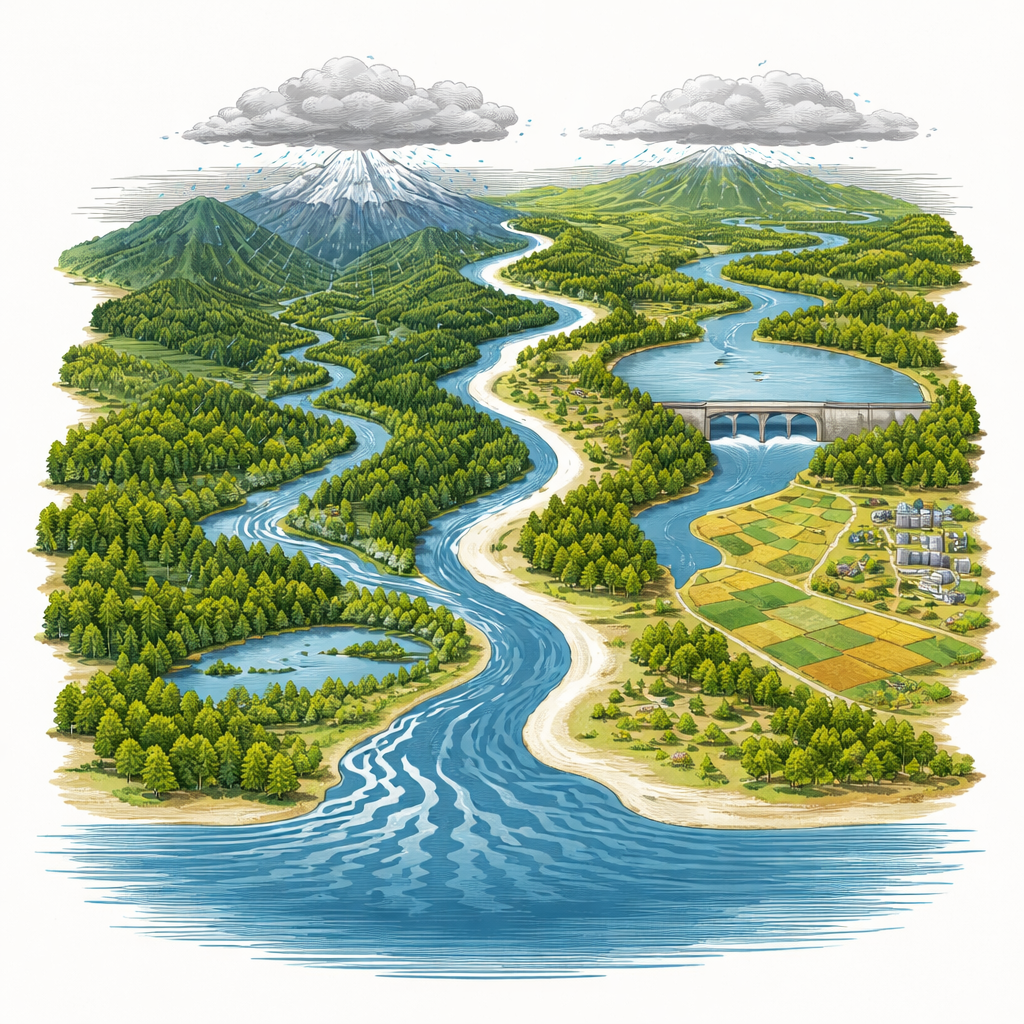
The Amur River, winding between China and Russia, is one of the great lifelines of Northeast Asia. It feeds wetlands, forests, farms, and cities, and shelters rare wildlife like cranes and big cats. Yet for most of the last century, scientists and planners have had only patchy records of how much water actually flowed through this vast system. This article describes how researchers have rebuilt a detailed, month‑by‑month history of the Amur’s flow over 120 years, both as it would have behaved in a mostly natural state and as it has actually flowed under dams, farms, and growing towns. These new records can help countries share water more fairly, protect ecosystems, and prepare for droughts and floods in a warming world.
A great river with few measurements
The Amur Basin stretches over 2.1 million square kilometers across Mongolia, Russia, and China, crossing mountains, forests, and sprawling wetlands. It supports rich biodiversity and major food‑producing regions. But long, continuous river records exist at only a handful of monitoring stations, mostly on the Chinese side. Many upstream areas in Russia and Mongolia have little or no direct measurement because of harsh terrain and political barriers to data sharing. Systematic records generally start only in the 1950s, and just two stations have data spanning a full century. This makes it difficult to understand how climate change and human activity have altered the river over time, and to plan for the future.
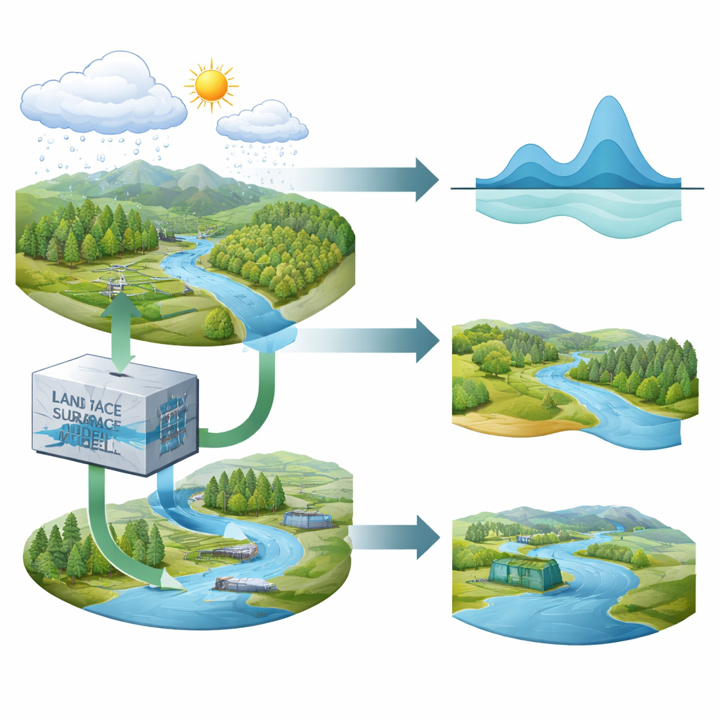
Rebuilding the river’s past on a computer
To close these gaps, the authors turned to advanced computer models that simulate how water moves through land and rivers. They used a land surface model called CoLM to represent how rainfall and snowmelt soak into soils, run off hillslopes, and feed streams, driven by a long‑term climate dataset that blends observations and weather re‑analysis back to 1901. The resulting runoff was then passed into a river routing model, CaMa‑Flood, which moves water along a realistic digital river network at fine spatial resolution. This framework allowed the team to estimate daily and monthly flows for every grid cell across the basin from 1902 to 2022, even where no gauges exist.
Nature’s river and our altered river
Crucially, the researchers did not produce just one reconstruction but two. In the “naturalized” version, land cover is held fixed and there are no reservoirs or withdrawals, so changes in flow reflect climate alone. In the “human‑influenced” version, they added major real‑world influences: expansion of cropland, growth of cities, water taken for households, industry, power plants, and irrigation, and the operation of 32 medium and large reservoirs whose construction dates and storage volumes are known. Historical land‑use snapshots represent key stages of development, from an early‑20th‑century landscape to the highly managed basin of the 2000s. This paired design makes it possible to tease apart how much of a change in flow comes from weather and how much from people.
Testing the virtual river against reality
The team checked their reconstructions against observations at five major gauging stations scattered along the Amur and its largest tributary, the Songhua. They used several statistical measures to judge how well monthly flows, seasonal patterns, and year‑to‑year variability matched what was actually measured. At most stations, both versions of the model reproduced overall volumes and timing well, and the human‑influenced version often outperformed a widely used global hydrological model. Where human interference is strongest, such as the Songhuajiang station downstream of the large Fengman reservoir, the difference was striking: a purely natural simulation overestimated peak summer flows and underestimated winter flows, while the human‑influenced run captured the way the reservoir cuts flood peaks and boosts low flows. The reconstructions also reproduced shifts in seasonality and most historical drought and flood episodes, including the record Amur flood of 2013 and severe drought in 2017.
What this means for rivers and people
For the first time, scientists and policymakers have two consistent, century‑long maps of how water has moved through the Amur Basin: one showing how the river might have flowed under climate alone, and one reflecting the combined imprint of climate and human decisions. These datasets can guide water‑sharing talks between countries, help assess risks to fisheries and wetlands, and support planning for dams and irrigation under future climate change. They also highlight that managing rivers is not just about how much rain falls, but about how societies store, divert, and consume that water. While uncertainties remain—especially in poorly monitored border regions—the study offers a powerful new lens on how a major transboundary river responds to both nature and human hands.
Citation: Feng, Y., Li, Y., Zhang, B. et al. Naturalized and human-influenced streamflow of the Amur River for century-scale hydrological assessment. Sci Data 13, 346 (2026). https://doi.org/10.1038/s41597-026-06685-7
Keywords: Amur River, streamflow reconstruction, dams and irrigation, climate and water, transboundary rivers