Clear Sky Science · en
Dataset of typical terminal lake and surrounding oasis outlines in arid/semi-arid endorheic basins based on remote sensing data
Why lonely desert lakes matter to all of us
Across the world’s great drylands, many rivers do not reach the sea. Instead, they end in “terminal lakes” – often ringed by thin green oases that support wildlife and millions of people. These fragile water bodies react quickly to drought, warming, and upstream water use, making them powerful warning signs of environmental stress. This article presents a new global dataset that carefully traces how a dozen such lakes and their surrounding oases have changed from 1985 to 2022, giving scientists and decision-makers a much clearer picture of water sustainability in some of the planet’s harshest landscapes.
Desert rivers that never reach the ocean
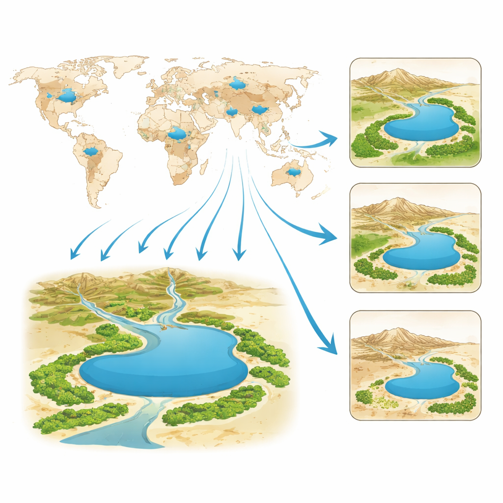
In arid and semi-arid regions, roughly half the land lies inside so-called endorheic basins—closed drainage systems where rivers have no outlet to the sea. Water that flows into these basins either seeps into the ground or evaporates, often collecting in terminal lakes at the lowest points. Around these lakes, oases form wherever there is reliable water, fertile soils, and vegetation that can withstand the surrounding desert. Famous examples include the shrinking Aral Sea in Central Asia, Lake Chad in the Sahel, the hypersaline Dead Sea in the Middle East, and smaller but equally telling lakes in China, Mongolia, East Africa, Bolivia, and the western United States. Because their level and area can change rapidly, these lakes and their oases act like natural gauges of both climate shifts and human water use.
Why existing maps fell short
Although scientists have assembled global maps of lakes, most of these products capture only snapshots in time or miss key desert lakes altogether. Some widely used databases lack records for important terminal lakes such as Taitema Lake at the end of China’s Tarim River, the Dead Sea, or East Africa’s Lake Abhe Bid. Others provide only one or a few years of data, making it difficult to track long-term trends, especially in the green belts of oases. High-precision maps of oases themselves are even rarer and are typically limited to single regions or a single year. These gaps have hampered efforts to understand how water storage, ecosystems, and human livelihoods in drylands have been changing over decades.
Watching remote lakes from space
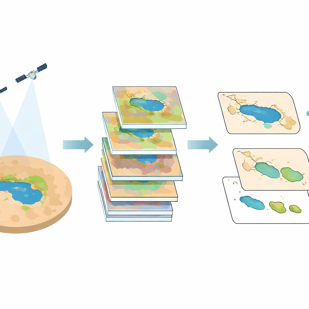
To close this gap, the authors built a 37-year record of terminal lake and oasis outlines for 12 representative inland rivers around the world. They relied on long-running Landsat satellite missions, which have photographed Earth’s surface at 30-meter resolution since the 1980s. For nine time slices between 1985 and 2022, the team assembled nearly cloud-free images for each basin, using automated tools to filter and combine many scenes into a single clear picture. They then calculated several simple color-based indicators that distinguish open water from land and vegetation from bare desert. A semi-automatic workflow first flagged likely water and oasis pixels and then converted them into smooth, vector outlines. Human experts carefully inspected and edited these boundaries, using both satellite images and detailed global land-use maps to fix misclassified patches and to capture built-up areas, marshes, and other overlooked oasis features near each lake.
How accurate and useful is the new dataset?
To test reliability, the researchers generated thousands of random points in and around each lake and oasis and checked each one against high-resolution historical imagery in Google Earth. The resulting accuracy was close to 90 percent for both water and oasis outlines, with statistical scores indicating strong agreement between the mapped shapes and what is visible in the imagery. The team also compared their lake areas with several existing global databases and found generally good consistency, especially for years and seasons that matched the Landsat observation window. For two Chinese basins with missing 1980s satellite coverage, they used land-use data to reconstruct earlier lake outlines; later satellite-based maps closely matched these reconstructions, suggesting that this workaround introduced little additional error.
What this means for water and life in drylands
The finished product is a collection of yearly boundary files—each one a digital outline of a terminal lake or its neighboring oasis, tagged with area, perimeter, climate zone, and land-cover type. These files can be opened in standard mapping and analysis software and combined with data on climate, population, water quality, or wildlife. Researchers can now track where lakes are shrinking or re-expanding, how far oases have advanced or retreated into the desert, and how management projects or diversions upstream have altered these lifelines. For example, the recovery of lakes such as Taitema and East Juyan Sea can be linked directly to large-scale ecological water conveyance projects, providing a concrete way to judge their success.
Reading the health of desert basins in a single glance
For non-specialists, the key message is straightforward: the shapes of terminal lakes and their surrounding oases tell a story about whether water use in a basin is living within its limits. By making these shapes visible and measurable over nearly four decades and across multiple continents, this dataset turns scattered satellite images into a coherent record of change. It offers a practical tool for spotting trouble—such as a steadily shrinking lake or a thinning green belt—early enough to adjust water policies, protect ecosystems, and safeguard communities that depend on these rare pockets of blue and green in an otherwise dry world.
Citation: Sun, Z., Wang, S., Yan, X. et al. Dataset of typical terminal lake and surrounding oasis outlines in arid/semi-arid endorheic basins based on remote sensing data. Sci Data 13, 362 (2026). https://doi.org/10.1038/s41597-026-06671-z
Keywords: terminal lakes, oases, drylands, remote sensing, water resources