Clear Sky Science · en
BaleUAVision: Hay Bales UAV Captured Dataset
Why Counting Hay Bales from the Sky Matters
Hay bales may seem like simple rolls of dried grass, but knowing exactly how many are in a field, and where they sit, is worth real money to farmers. Precise counts guide how much feed is available for animals, how many trucks are needed, and how long harvest crews must work. This article presents BaleUAVision, a new open dataset built from drone images that makes it easier to automatically spot and count hay bales from the air, helping move agriculture toward smarter, more efficient management.
Farms Seen from Above
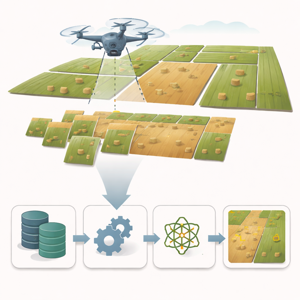
BaleUAVision is based on 2,599 sharp color photographs taken by drones flying over 16 hay fields in northern Greece. The fields cover about 232 acres and span two regions with different landscapes: broad plains around Xanthi and more varied terrain near Drama. Flights were made in the summer of 2023, under clear skies and gentle winds, at heights between 50 and 100 meters and moderate speeds. The result is a realistic snapshot of post-harvest fields, with bales scattered in patterns that reflect local farming practices and terrain rather than a laboratory setup.
Turning Pictures into Usable Data
Collecting images is only the first step. The team carefully processed all photos, discarding those with blur or other issues, and then stitched them together into detailed overhead maps, called orthomosaics, for each field. These mosaics were used to manually count every bale as a trustworthy reference. At the same time, each individual bale was traced by hand on the original photos as a precise outline, not just a rough box. This painstaking work created high-quality “ground truth” data in several common file formats, so that many different artificial-intelligence tools can be trained and tested without extra conversion work.
Diversity in Flights, Strength in Models
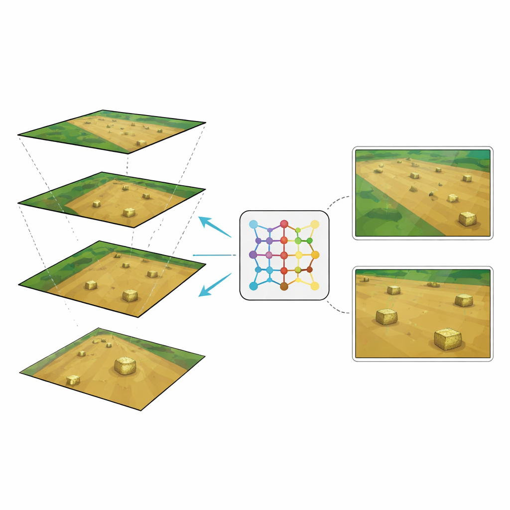
The way a drone is flown—how high, how fast, and how much its photos overlap—shapes what it sees. BaleUAVision deliberately varies these flight settings so that detection systems trained on it do not break down when conditions change. Lower flights capture more detail but less ground in each frame; higher flights see more area but make bales appear smaller. By including images at different heights and in different lighting conditions across two regions, the dataset captures both geographic variety and the kinds of camera-scale changes that real-world operations face. Tests show that this variety helps artificial-intelligence models recognize bales even when they are photographed in new places or from new heights.
Putting the Dataset to the Test
To check whether BaleUAVision is truly useful, the authors trained a popular detection system known as YOLOv11 to find hay bales in the images. They then challenged the model in two ways: by asking it to detect bales in fields from a different region than it had seen before, and by changing the flight height between training and testing. When trained on the dataset, the system detected almost all bales in new fields with very few false alarms. It also handled higher flight heights well when it had seen lower ones during training. However, a model trained only on high-altitude images struggled with close-up views until the researchers added even a small number of lower-altitude examples, showing how modest but well-chosen extra data can greatly boost reliability.
Beyond Generic AI, Toward Field-Ready Tools
The team also compared their specialized, bale-trained model with large general-purpose vision systems that are designed to “segment anything” in an image. While these foundation models are powerful in many settings, they performed noticeably worse on tightly packed, small hay bales against busy field backgrounds. The tailored model trained on BaleUAVision was not only more accurate but also more practical for running on real drones and farm computers. This highlights how carefully crafted, field-specific data can turn broad artificial-intelligence advances into tools that genuinely work at the farm scale.
From Better Counts to Smarter Farming
In plain terms, BaleUAVision gives researchers and companies a rich, freely available set of drone images and bale outlines to build and test bale-counting robots and software. With it, they can create tools that quickly and reliably tell farmers how many bales they have, where they lie, and how best to collect them—saving fuel, time, and labor. The same data can also support studies of field conditions, logistics planning, and even future farm robots. By opening this dataset to the public, the authors lay a foundation for turning simple hay bales into a gateway for more precise, data-driven agriculture.
Citation: Karatzinis, G.D., Gkelios, S. & Kapoutsis, A.C. BaleUAVision: Hay Bales UAV Captured Dataset. Sci Data 13, 313 (2026). https://doi.org/10.1038/s41597-026-06622-8
Keywords: precision agriculture, drone imagery, hay bale detection, computer vision, remote sensing dataset