Clear Sky Science · en
Crowdsourced biodiversity monitoring fills gaps in global plant trait mapping
Why everyday nature sightings now matter to global science
From backyard photos of wildflowers to careful surveys in remote forests, people around the world are recording where plants live and what they are like. This study shows how those scattered observations, when combined with satellite images and expert field data, can be turned into detailed global maps of how plants grow, survive, and reproduce. These maps help us understand how forests, grasslands, and other ecosystems respond to climate change and can guide efforts to protect biodiversity.
What makes plants tick
Plants differ in many measurable ways: how big their leaves are, how dense their wood is, how deep their roots go, or how much nitrogen they pack into a leaf. These “functional traits” control how plants use light, water, and nutrients and together shape how entire ecosystems work. They influence how much carbon forests store, how quickly water cycles through landscapes, and how resilient vegetation is to heat, drought, and disturbance. Scientists would like to know how these traits are distributed across the planet, but direct measurements in the field are time-consuming and unevenly spread, leaving large regions of the world poorly sampled.
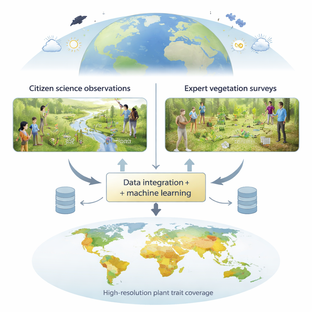
Turning scattered records into a global picture
To fill these gaps, the authors built a framework that merges three main kinds of information. First are expert vegetation surveys, where trained botanists record all plant species and their abundance in carefully chosen plots. Second are crowdsourced records collected through platforms that feed into the Global Biodiversity Information Facility, where citizens upload geotagged observations of plants. Third are trait measurements from a large international database that compiles lab and field measurements such as leaf chemistry, plant height, or seed size. These biological data are then linked to high-resolution environmental layers derived from Earth-observing satellites and climate and soil maps, such as surface reflectance, temperature, rainfall, and soil properties.
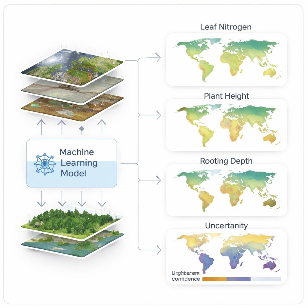
How the modeling works under the hood
Using these inputs, the team trained advanced machine-learning models to predict the average trait values of local plant communities for 31 different traits, at spatial grains as fine as one square kilometer. They tested three approaches: using only expert plot data, only citizen science data, or a combination of both. To avoid fooling themselves with overly optimistic results, they validated the models using a special form of cross-checking that separates training and testing areas in space. This allowed them to see not only how accurate the predictions were where data existed, but also how well they transferred to new regions with different environments.
What the maps reveal about data power
The combined approach outperformed or matched previous global trait maps for key traits such as specific leaf area and leaf nitrogen content, reaching correlation values up to about 0.65 with independent survey data. Expert plot data alone were slightly more accurate on average in places with good coverage, but adding citizen science observations greatly expanded the areas where the models could make reliable predictions and reduced uncertainty, especially in remote or under-sampled regions like deserts, alpine zones, tropical forests, and wetlands. The study also showed that different traits are best predicted at different map resolutions: some respond mainly to local conditions, while others track broad climatic gradients, highlighting that there is no one-size-fits-all scale for understanding plant strategies.
Why this matters for the planet and for you
In practical terms, these new maps give ecologists and climate modelers a much sharper, more complete view of how plant communities function worldwide. They can be used to improve simulations of carbon and water cycles, refine how we classify biomes, and identify regions where unique or vulnerable plant strategies may be at risk. Perhaps most importantly, the work demonstrates that everyday observations from citizen scientists, when carefully combined with expert data and satellite measurements, can meaningfully advance global change research. As more people document the plants around them and as remote-sensing technologies improve, our picture of the living surface of Earth will become even clearer and more useful for guiding conservation and climate action.
Citation: Lusk, D., Wolf, S., Svidzinska, D. et al. Crowdsourced biodiversity monitoring fills gaps in global plant trait mapping. Nat Commun 17, 1203 (2026). https://doi.org/10.1038/s41467-026-68996-y
Keywords: plant traits, citizen science, remote sensing, biodiversity mapping, ecosystem function