Clear Sky Science · en
Local cloud enhancement associated with urban morphology: evidence from observations and idealized large-eddy simulations
Why City Shapes Matter for the Sky
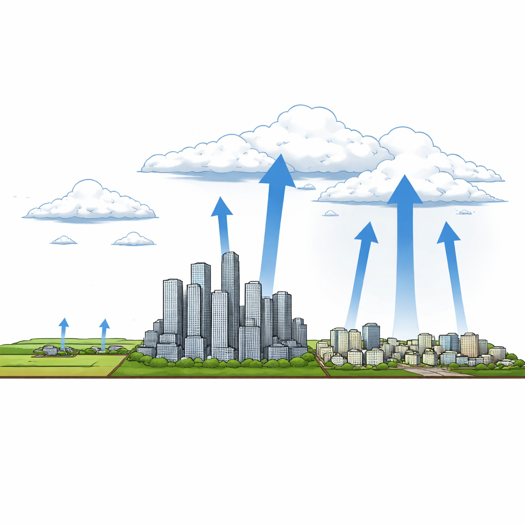
Cities do more than change skylines and traffic—they also reshape the sky above them. Many urban areas are known to have more low clouds than their rural surroundings, but the reasons why have remained murky. This study asks a deceptively simple question: does the way a city is built—how tall and tightly packed its buildings are—change how clouds form overhead? By blending detailed computer simulations with satellite data from 44 major U.S. cities, the researchers reveal that urban form itself can help power or hinder the rising motions of air that make clouds.
How Cities Stir the Air
When the sun heats the ground, warm air rises and can carry moisture up high enough for clouds to form. Cities, with their hard surfaces and tall structures, heat differently from nearby countryside. That contrast sets up a kind of "urban breeze," in which air flows from cooler rural areas toward the warmer city and then rises. At the same time, buildings act like rough obstacles, slowing and redirecting the wind. This study isolates the role of that physical structure—the height, spacing, and density of buildings—by running large-eddy simulations in which both city and countryside have the same moisture supply and similar overall heating patterns. That way, any differences in clouds must come from the way the urban surface is shaped, not from extra moisture or pollutants.
Simulated Skies Above Different City Layouts
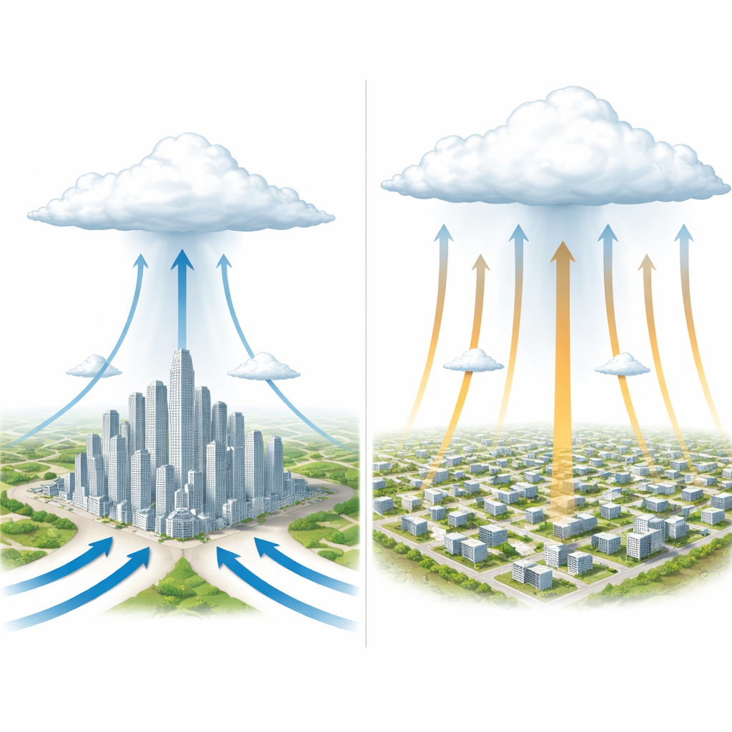
The researchers simulated seven idealized urban types, ranging from tightly packed high-rise districts to sparse low-rise areas with wide streets. They found that compact high-rise cities tended to produce strong rising motions right at the edge where city meets countryside, creating more clouds there but relatively fewer over the inner core. In contrast, low-rise, more open layouts fostered broad, coherent plumes of rising air throughout the urban core, especially over street intersections, leading to clouds spread across the whole city. A key result was a tight link between how energetic these upward motions were and the overall amount of cloud water in the atmosphere above the city: stronger and more organized updrafts meant more shallow cumulus clouds.
Two Ways Buildings Change Vertical Motion
To explain these patterns, the team focused on two distinct zones. At the urban edge, taller buildings increase roughness, causing air to pile up and converge, which strengthens the upward branch of the urban breeze. This mechanism favors cloud formation near the boundary between urban and rural areas. In the city core, however, densely packed buildings act as strong brakes on the flow. They sap energy from vertical motions, limiting how efficiently heat and moisture can be transported upward. The researchers distilled these effects into two characteristic speeds: one describing the strength of the urban breeze at the edge, and another describing the vigor of turbulent up-and-down motions over the core. Taller buildings amplify the edge updraft, while higher building density weakens turbulence above the core, reducing cloud formation there.
Satellite Clues from Real Cities
Do these idealized mechanisms show up in the real world? To find out, the authors analyzed nearly two decades of satellite observations of nighttime cloud cover over 44 large U.S. cities during warm months. They compared how much more cloudy cities were than their rural surroundings with simple measures of city shape: the ratio of building height to street width, and the fraction of land covered by building footprints. Cities with taller buildings relative to street width tended to show stronger cloud enhancement, consistent with stronger urban breezes at their edges. In contrast, cities with more ground area covered by buildings—denser canopies—tended to have less extra cloud cover, matching the idea that overly dense layouts suppress the vertical mixing needed to feed clouds.
What This Means for Future Cities and Forecasts
This work shows that the design of a city—tall versus low, open versus tightly packed—can leave a clear fingerprint on the clouds above it, even when other factors like moisture supply are held constant. Taller, less densely packed structures promote the rising motions that build shallow clouds, while dense arrays of buildings can choke off that vertical transport. By turning these ideas into simple measures of vertical motion, the study offers a path to representing city-specific cloud effects in weather and climate models that cannot resolve individual buildings. In practical terms, it suggests that urban planning choices do not just shape life on the ground; they also help set the stage for local cloudiness, with implications for temperature, rainfall, and how cities experience a changing climate.
Citation: Cui, Y., Chen, S., Xue, L. et al. Local cloud enhancement associated with urban morphology: evidence from observations and idealized large-eddy simulations. Nat Commun 17, 2378 (2026). https://doi.org/10.1038/s41467-026-68986-0
Keywords: urban clouds, city morphology, boundary layer, large-eddy simulation, urban climate