Clear Sky Science · en
Ship wake-induced water column mixing and meter-scale seabed erosion in the Baltic Sea
Why busy shipping lanes matter beneath the waves
Most of the goods we buy travel by sea, yet we rarely think about what those giant cargo ships do to the oceans they cross. This study peeks under the surface of the Baltic Sea, showing that the invisible wakes of passing ships are strong enough to stir up entire columns of water and carve the seabed by more than a meter over just a decade. That hidden reshaping of the seafloor and mixing of water layers may be quietly altering marine habitats, oxygen levels, and even climate‑relevant gases across one of the world’s most trafficked inland seas.
A shallow sea under heavy pressure
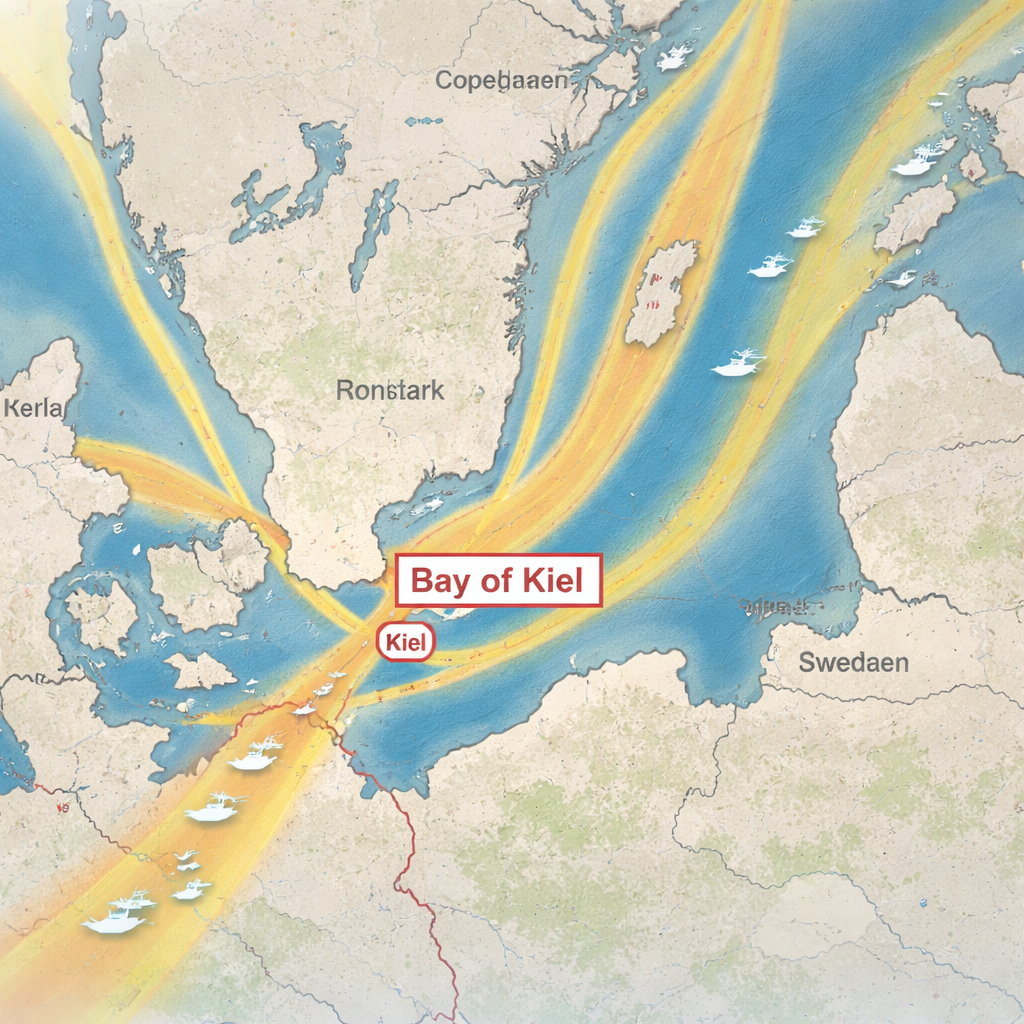
The Baltic Sea is a relatively small, shallow, almost enclosed sea surrounded by tens of millions of people. Much of it is less than 20 meters deep, which means that human activities at the surface can easily affect the entire water column down to the seabed. One of the most widespread pressures is commercial shipping: in the western Baltic, dense ship routes converge on the Bay of Kiel, gateway to the Kiel Canal, with dozens of large vessels passing every day. While we know ships make noise, burn fuel, and sometimes damage the seabed when they anchor, their everyday motion through open water has been much less studied. This work focuses on that gap, asking how the wakes from moving ships reshape both the seafloor and the water above it.
Reading the seabed like a time‑lapse photograph
The researchers compared detailed sonar maps of the Bay of Kiel seafloor collected in 2014 and again in 2024. This area lies along a narrow traffic corridor where large cargo ships and ferries follow fixed routes in and out of the canal. The team divided the seabed into three zones: a quieter muddy area, a rougher zone of glacial deposits, and a central strip directly under the main shipping lanes. In that central strip they found hundreds of shallow pits around buried boulders, trains of sand dunes, and two long, low ridges of sand that run for more than five kilometers. By subtracting the old and new depth maps, they discovered that some spots had become up to 1.5 meters shallower or deeper over ten years—changes far larger and faster than expected from natural sedimentation alone, and concentrated exactly where ships pass most often.
Following ship wakes from the surface to the seabed
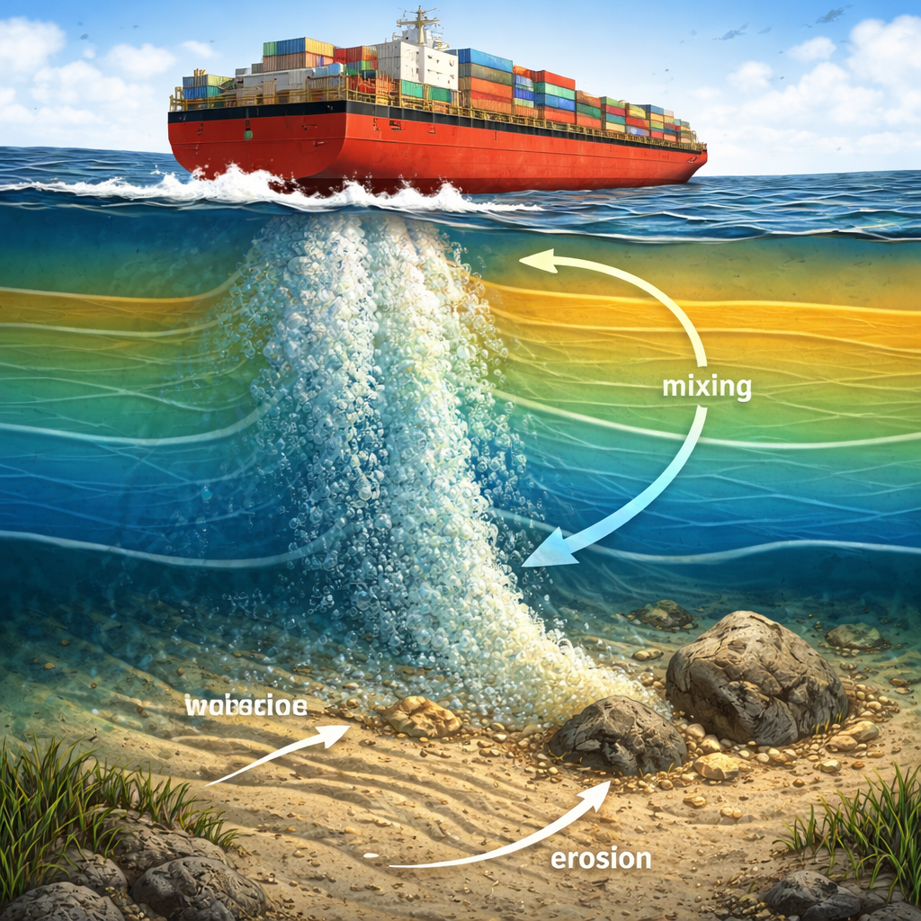
To see how ships could cause such dramatic reshaping, the team tracked the wake of three cargo vessels and two ferries as they crossed the bay. Using a fisheries echosounder, they imaged clouds of bubbles and turbulence trailing behind the propellers as the research ship slowly crossed the wake. In water 12–16 meters deep, the disturbance often stretched from the surface all the way down to the seafloor. Outside the wakes, the water column showed distinct layers of different temperature and saltiness, separated by sharp density steps. Inside the wake, those layers bent, rippled like internal waves, and in places broke apart, revealing strong vertical mixing. Calculations of the force exerted by the propeller jets on the bottom showed that the near‑bed stress is high enough to move sand grains, lift them into suspension, and gradually wear away the underlying glacial deposits.
From pits and ridges to ecosystem change
The pattern of seabed features points directly to repeated scouring by ship wakes. Around protruding stones, fast flows dig elongate depressions with a steep “upstream” wall and a gentle “downstream” slope whose orientations match the two main sailing directions in the traffic separation scheme. Sand eroded from the till is not simply lost; it is shuffled around within the corridor, building ripples, smooth sandy patches, and the striking linear ridges that sit under the routinely traveled paths of twin‑propeller ferries. Coarser rocks remain as anchors for further erosion, while the finest clay and silt are carried away by background currents. When the authors extrapolated their measured erosion rates to all shallow, heavily trafficked areas of the Baltic, they estimated that ship wakes may already have mobilized on the order of a cubic kilometer of sediment—enough to matter for regional element and carbon budgets.
What it means for life and climate in the Baltic
For a non‑specialist, the key message is that everyday ship traffic does much more than leave a white froth on the surface. In shallow, busy areas like the Bay of Kiel, propeller wakes repeatedly punch through natural layering in the water, blending oxygen‑rich and oxygen‑poor waters, stirring up nutrients, and likely influencing greenhouse gas release from the seabed. At the same time, they reshape the seafloor, making it harder for stable bottom communities to establish and favoring species that can cope with constant disturbance. These effects, multiplied over decades and thousands of voyages, could subtly but significantly reshape Baltic Sea ecosystems and chemistry. The authors argue that we need better monitoring of these wake‑driven changes and that even small adjustments to shipping routes might help limit erosion “highways” on the seafloor while keeping global trade moving.
Citation: Geersen, J., Feldens, P., Rollwage, L. et al. Ship wake-induced water column mixing and meter-scale seabed erosion in the Baltic Sea. Nat Commun 17, 1350 (2026). https://doi.org/10.1038/s41467-026-68875-6
Keywords: ship wakes, seafloor erosion, Baltic Sea, water column mixing, marine shipping impacts