Clear Sky Science · en
Urban planning genes of Fu prefecture in Ming Dynasty China based on HGIS
Why old Chinese cities still matter today
Across China, many old city centers—with their walls, gates, and winding streets—are being squeezed by modern development. Behind their bricks and moats lies a quiet question: were these places planned according to a shared pattern, and could that pattern help guide how we protect and reuse them today? This study looks at a specific layer of historic cities from the Ming dynasty, called Fu Prefectures, and treats their layouts almost like living DNA, searching for recurring “planning genes” that shaped how they were built.
From scattered ruins to a big-picture view
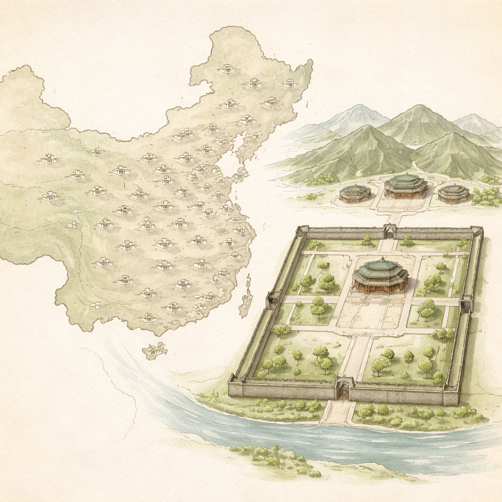
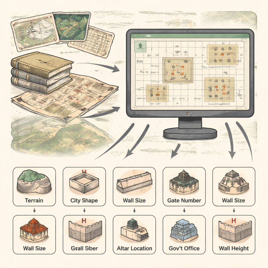
Instead of focusing on one famous capital like Beijing, the researchers assembled information on 167 Fu Prefecture cities spread across the Ming empire. These were mid-level administrative centers—below the capital, above county towns—yet crucial for government, defense, trade, and ritual life. To see patterns that individual ruins or tourist sites can’t reveal, the team combined local gazetteers, old maps, archaeological reports, and modern satellite images. All this material was fed into a Historical Geographic Information System (HGIS), a digital map where each city is tagged with details such as its terrain, shape, wall size, gate count, and locations of key civic and ritual buildings.
Turning city features into “planning genes”
The authors borrow the idea of “genes” from biology but apply it to city planning. A planning gene is defined as a simple, repeatable element of urban design—like the number of gates or the position of a temple—that appears again and again because it carries accepted planning wisdom. By running statistical analyses across the HGIS database, they identified seven such recurring genes for Ming Fu Prefectures: the surrounding terrain, the basic city shape, the circumference of the walls, the number of gates, where altars and temples were placed, where government offices sat inside the walls, and how tall and thick those walls tended to be. Each gene captures a small slice of how people in the Ming era thought a proper city should be laid out.
What the numbers say about old planning wisdom
The data show that most Fu Prefecture cities sat between mountains and rivers, or at least near water, echoing long-standing Chinese ideas about harmony with nature and the value of natural defenses. City outlines were usually rectangular or close to it, reflecting ritual ideals of order but with enough flexibility to adapt to hills and rivers. Wall perimeters clustered around a moderate size, and four gates—one on each side—were by far the most common pattern. Ritual altars for land and grain typically occupied the northwest of the city, while wind and rain altars lay to the southwest, matching written Ming regulations. Government offices tended to be in the northern part of the city, especially the northwest, reinforcing the symbolic link between political authority and specific compass directions. Wall heights and thicknesses also fell into a fairly narrow band, suggesting an unwritten standard of “just enough” defense for this level of city.
A flexible blueprint, not a rigid stamp
Comparing these results with much older planning texts, the authors argue that Fu Prefectures did not simply copy idealized capital cities at a smaller scale. Instead, they translated ancient planning rules into workable solutions for local conditions—balancing ritual symbolism, military needs, and the practical demands of water supply, trade routes, and topography. The team’s “planning gene” framework moves beyond describing city shapes to explaining why those shapes persist, and shows how digital mapping can connect written traditions with the physical remains on the ground. Their approach also highlights differences from city-making traditions elsewhere, such as European star forts or modern Paris, which tended to prioritize defense or traffic over ritual meaning.
What this means for today’s historic cities
For non-specialists, the key takeaway is that many old Chinese cities share a hidden structure that is neither accidental nor purely decorative. The seven planning genes identified here encode a deep continuity of ideas about how power, belief, and nature should be arranged in space. Recognizing those genes can change how we protect and reuse historic districts: instead of only preserving walls and gates as tourist backdrops, planners can aim to keep—or thoughtfully reinterpret—the underlying patterns of terrain use, city shape, and ritual and civic locations. In that sense, Ming Fu Prefecture cities are not just relics; they are legible blueprints of a planning tradition that has quietly shaped Chinese urban life for over two thousand years.
Citation: Zou, H., Li, A., Rao, J. et al. Urban planning genes of Fu prefecture in Ming Dynasty China based on HGIS. npj Herit. Sci. 14, 72 (2026). https://doi.org/10.1038/s40494-026-02332-x
Keywords: Chinese urban history, Ming dynasty cities, urban heritage, historical GIS, urban planning genes